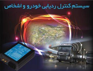
Vehicle tracking device
Vehicle tracking device is a terminal with GPS and GSM connectivity, which is able to get device coordinates and other data and transfer them via GSM network (SMS or GPRS). So you can track your remote objects easily and be informed of their position in real time.
Solution overview
GPS (Global Positioning System) Definition
Global Positioning System which is used to record geographic location is a satellite-based navigation system consisting of a network of 24 GPS orbiting satellites, eleven thousand nautical miles in space, in six different orbital paths. The satellites are constantly moving, making two complete orbits around the Earth in just under 24 hours. That’s about 108 miles per second. GPS receiver is used as location finder in tracking devices. It should be received at least 3 satellites signals to determine the exact location of moving object. Data from satellites can be analyzed by the device and so the position of moving object is calculated.
The introduction of GPS tracking device
Vehicle tracking device is a terminal with GPS and GSM connectivity, which is able to get device coordinates and other data and transfer them via GSM network (SMS or GPRS). So you can track your remote objects easily and be informed of their position in real time.
Hardware functionalities of Vehicle Tracking System
• real time organizational personnel / vehicle tracking
• defining coordinates (geofence)
• remotely changing the device parameters via SMS
• storing data in case of no GPRS availability
• internal memory
• high-precision GPS
• possibility to install insensibly
• possibility to move device easily from one vehicle to another
Software functionalities of Vehicle Tracking System
• Determining access level for different users.
• Real time processing power for all vehicles in the proposed system.
• Recording and storing data without any software restriction.
• Possibility to define working groups and access levels for users in the server software.
• Possibility to define the allowed range (Geofence).
• Providing administration working report, statistical and graphical.
• Minimum functionality with World’s show engines such as Google Earth and Virtual Earth and Google map.
AVL system applications
• Vehicle Tracking
• Container and valuable objects tracking
• Fleet Management
• Moving object tracking terminal
• Warning system for car
• Intelligent Vehicle Systems and their relationship to Center
• People Tracking
• Specific patient tracking (Alzheimer’s, heart disease, MS) and necessary contact with them
Tolue Engineering Co. by developing the scope of its activities in data entry automation, tracking and identification and AVL systems (vehicle tracking) founded Tolue Aryan Engineering Co.
Aryan Engineering Co. has professionally begun its activity on GPS / GSM based tracking systems and up to now, this has recorded successful projects in its report card.
- The aims of Aryan Engineering Co. to provide AVL system
- Controlling the transportation fleet and organizational personnel
- Expediting and facilitating the control of transportation, traffic, relief, distribution, and monitoring systems and …
- Reducing organizational costs
- Increasing employees’ efficiency
- Increasing the security
- Providing modern technologies for agencies and organizations involved in monitoring and control activities